Welcome back fellow roboticists! I trust you guys had a great weekend. Over the weekend I decided to supercharge the roll-out speed for this project. So, without further delay, we present Rover 2 RTK Autopilot Upgrade:
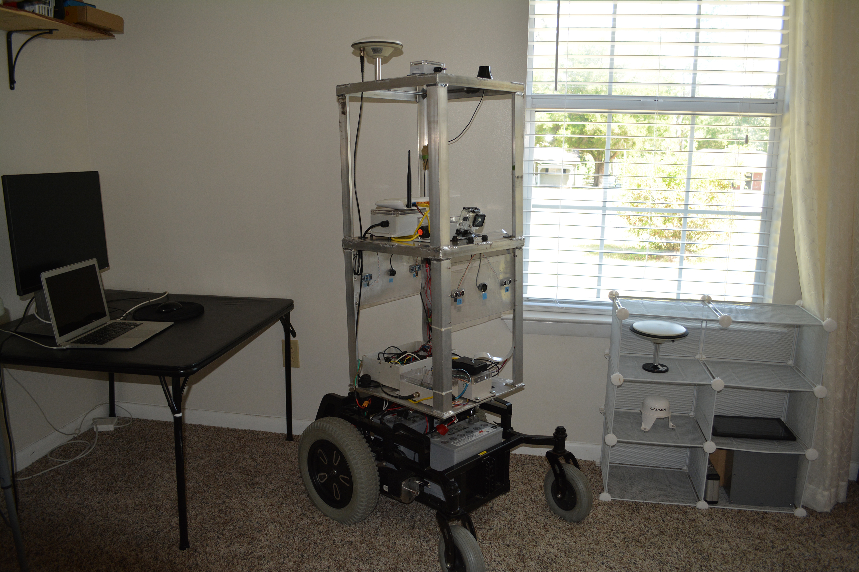
Whoa, last time we talked we just had a wheelchair base with a humble metal plate as a platform! Hey, this upgrade is my idea of an exciting weekend. Let’s look into it a little more…
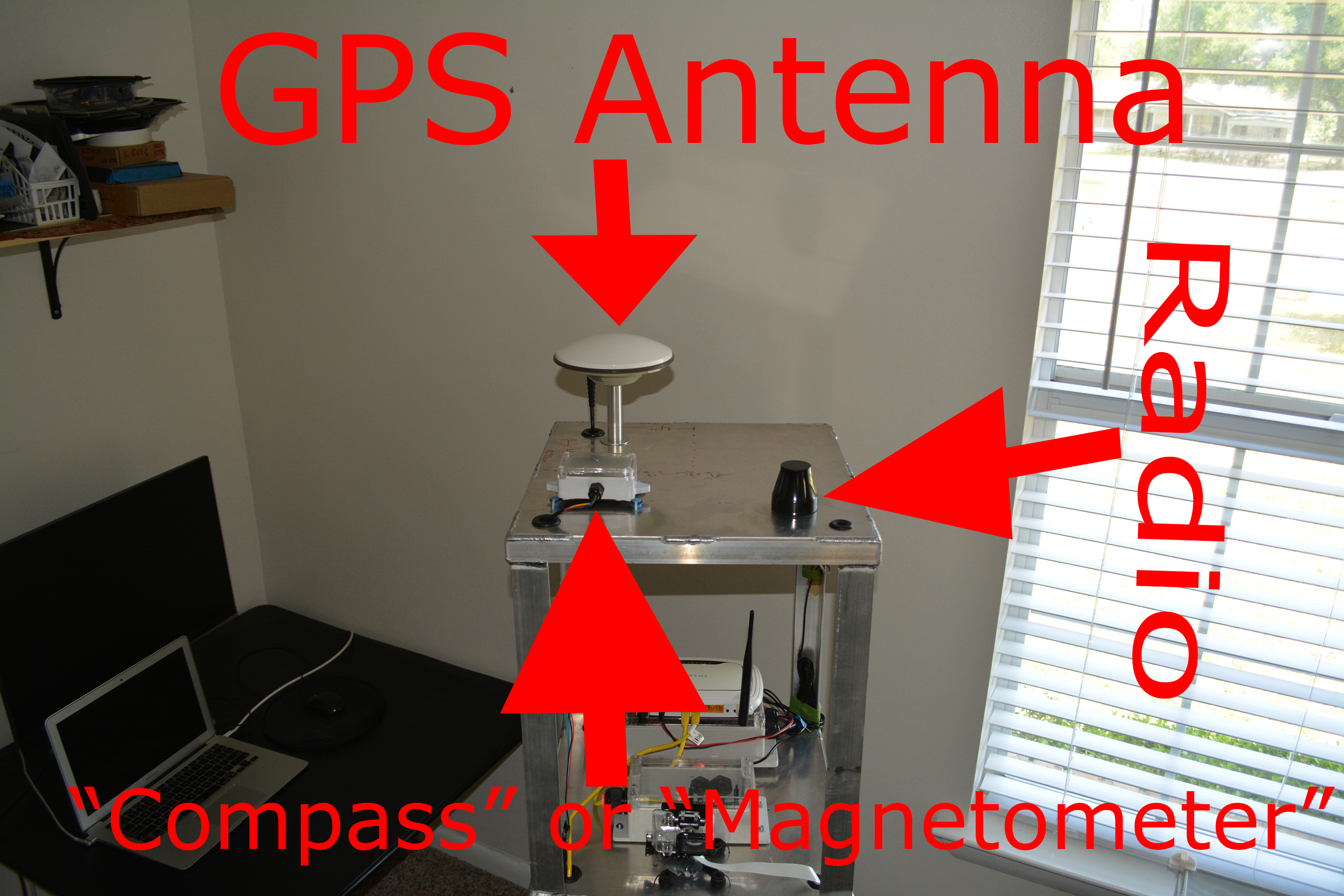
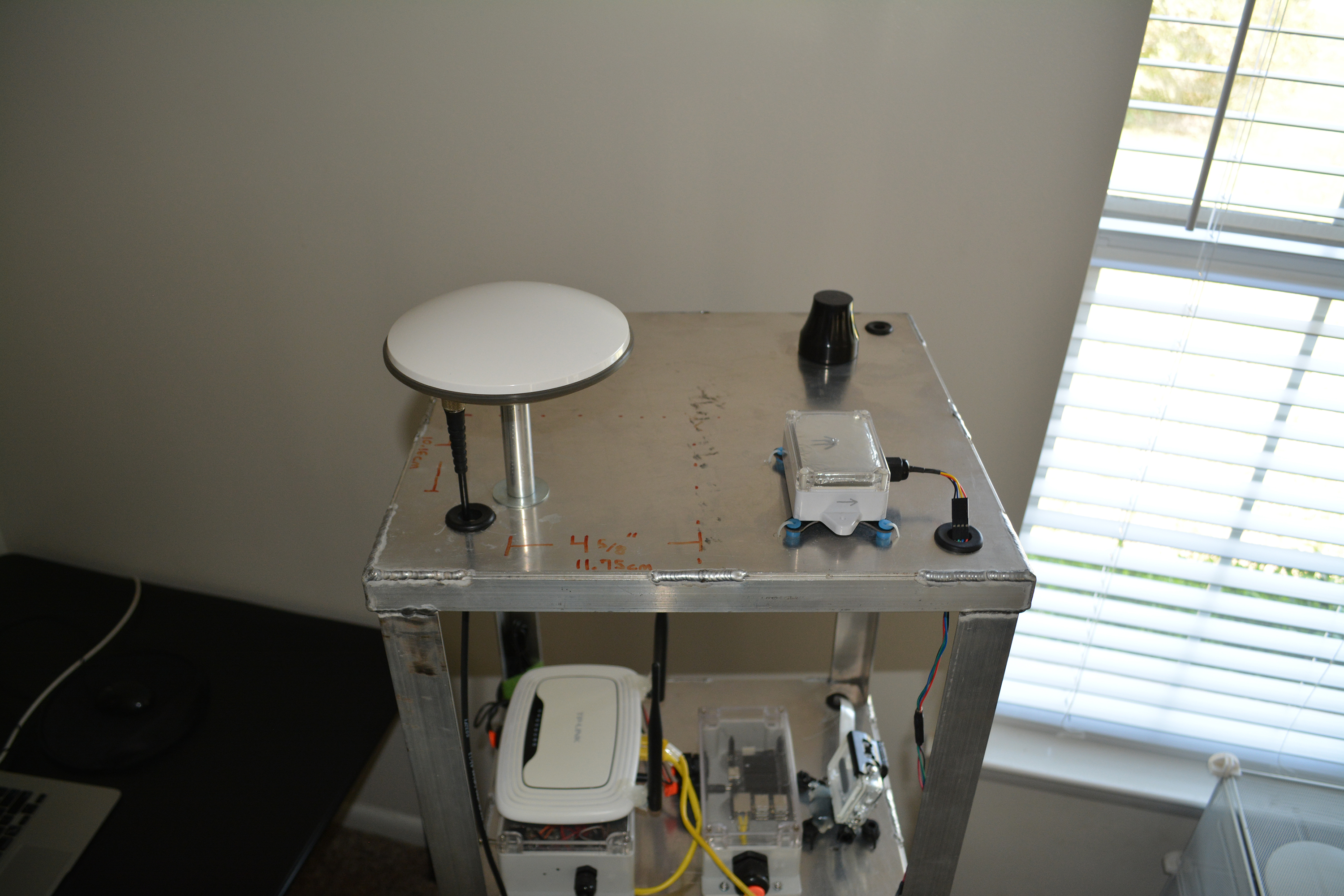

So now that you’ve seen all 4 side of the top, let’s break down what we’re looking at.
Dual Frequency GNSS
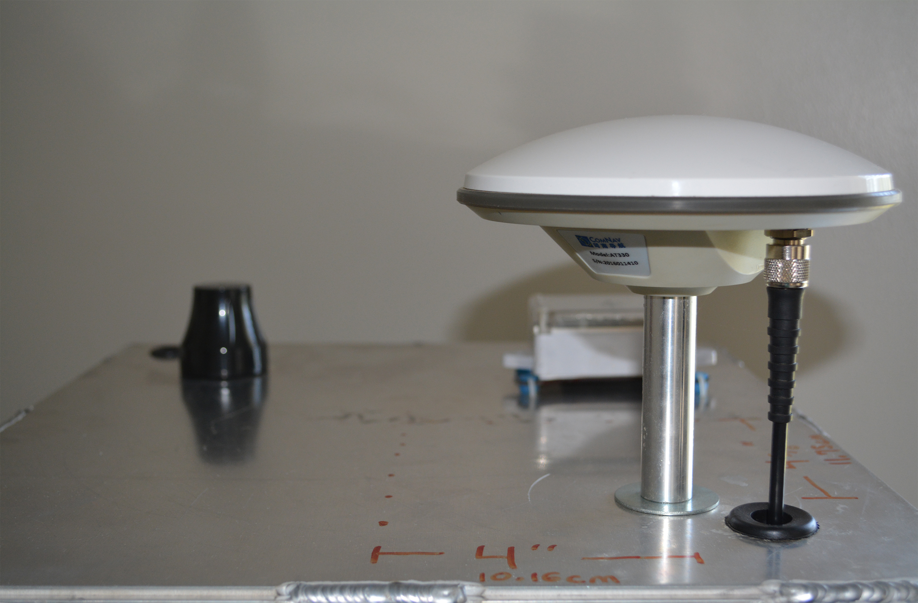
Prominently featured in the pictures above is a big beautiful L1/L2 GPS/GLONASS antenna. If you’re familiar with this technology, you realize that this project just got a lot more expensive. If you’re not familiar with this technology, you’re probably wondering why I just starting dropping acronym bombs on you. Let’s try to clarify these technologies concisely:
GNSS — Global Navigation Satellite System
Generic term for satellites orbiting earth that can provide ridiculously good location data. You get street cred for saying “GNSS” instead of “GPS”.
GPS — Global Positioning System
Satellite “constellation” owned by USA. While people often refer to all GNSS constellations generically as “GPS”, technically GPS refers to the American satellites. Other major constellations include GLONASS (Russia — very solid in USA), BDS (China — limited coverage in USA), and Galileo (EU — some coverage in USA).
RTK — Real Time Kinematic
Technology that enables our GNSS receiver to provide sub-inch (centimeter) accuracy. Yes, you read that right, the GPS knows where it’s at ON THE FACE OF PLANET EARTH TO WITHIN LESS THAN 1 INCH! Since we’re going to build a big rover capable of running missions like mowing grass or applying fertilizer, this technology is a pivotal enabling technology for what we will accomplish. Technically, RTK is accomplished by a software algorithm that uses the raw data from the GNSS receiver and another fixed source (known as a “Base Station” or a “Correction Source”). RTK is an entirely fascinating technology and we’ll have much more to say about it in upcoming posts.
L1/L2/L5 — GNSS Signal Frequencies
Different frequencies that GNSS codes are transmitted on. Click the L1/L2/L5 link for a technical explanation. Here’s a nontechnical explanation for what L1/L2 GNSS means for us:
- Much more robust RTK
- Very expensive (think orders of magnitude — but becoming less expensive daily — more on this next post)
So, if I were to summarize some useful GNSS knowledge for the novice, it would be this:
- GPS: AWESOME
- GLONASS: AWESOME
- RTK (via L1/L2 GPS/GLONASS): AWESOME
- Galileo: often promises to be awesome in a few years — I can’t speak to their current status
- BDS is promising if you live under their satellites’ orbits (China, Australia, NOT USA)
- Promises about future GNSS features are curiously fickle
- GNSS SMEs are farmers and surveyors. If you want to know the gospel on GNSS, just hit a precision agriculture forum or surveying forum. Ignore this advice and buy an L1-only GPS-only RTK system you see advertised and you may regret it.
Wrapping Up
Perhaps the most important (and least answered) question about L1/L2 RTK GNSS equipment is this: how much does it cost? I’ll leave you in suspense…’till next time!
Sincerely,
Roby
Leave a Reply